Help
How to
Please read this page on the how to.
There are a number of things that you need to know in order to make maximum use of our web-site. There are a number of great features that really come in handy.
Calculate distance
This is, of course, the first thing you need to know and do. Just look at how far the distance is between two points. We have to show: the distance measured as the crow flies, how far is it to drive with the car, on the train, and, if possible, take the bus. It is an estimate of the period of time in order to cover the distance to and the use of trains and buses.
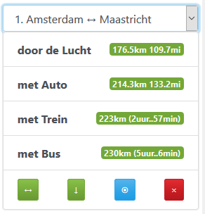
Image: immediately results for the distance calculation
Download in GeoJSON formaat
What is GeoJSON? However, that has been the default geographic data (read data) and store it. Take a look at the Wiki geojson.org. There are lots of applications that may be using GeoJSON.

Image: the button download GeoJSON
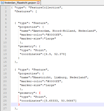
Image: Amsterdam Maastricht in GeoJSON format
Current location
The current location button. If you click on this button will ask the site for permission to use your location information to be able to use it. A very useful feature for your current location will be used as a starting point to calculate the distance.
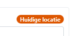
Image: the current location button
Download CSV
You can use multiple distances between the different locations. It is to be (temporarily) stored in the memory of the web-page. It's convenient that you have this data as a CSV file, you can download it. And with this information you can then share it with your friends, family or co-workers. Please note that a CSV file is a format that Microsoft Excel will automatically recognise it.

Image: the download CSV button